

There was a slight pang as I left Oregon. Many pangs actually as I have no idea when I actually left Oregon and entered Washington. Sometimes, they will have a big sign saying “welcome to this state.” On the back roads and byways, you see a cow or something. There was a lot more in Oregon I wanted to see. They were all just short drives from Portland. Of course, with close to 14,000 miles now, anything less than 5 hours is a short drive. I was warned that some of the hikes were closed, I wanted to bother with holiday traffic as little as possible, so it was time to head north and finish the western coast.

First stop was Mt. St. Helens. There was a lot more driving in what I now consider the Pacific style. That’s one of the things that struck me about California and Oregon. It’s coastline. On the east coast, that means flat. In Florida, you have close to 66,000 square miles just above sea level. The west coast isn’t like that at all. The hill and mountains jut right up against the ocean.
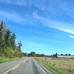
I do love the driving out here. The windy roads, passes and regular signs telling you the elevation. After I left Route 5, firmly and without doubt in Washington, I gradually made my way up to to Mt. St. Helens. To jog your memory or for those who might not know, it blew in 1980. Scientists predicted two years before that it would blow before 2000. On my birthday in 1980, March 20th, there was a slight earthquake heralding what would be a massive eruption on May 18th. At the time, it was the worst natural disaster to ever hit the United States. Logging interests were at odds with geologists. 57 people died when it blew with the entire southern face crumbling and 540 million tons of ash exploding into the air.
On the drive up to Mt. St. Helens, you can see what the area probably looked like. Through the mountains and passes, all of the trees look like they have been manicured on the mountains. Broad stretches of logged lands form straight lines along the tree line. That was a bit more than 40 years ago.
The viewing area has spectacular views of the mountain and surrounding lands. It’s interesting to me because it is as if you get to see the land naked. Trees cover everything so you only get brief glimpses of rivers and streams and the layers of the land itself. In the area below Mt. St. Helens, that covering is stripped away. New growth has begun but the land is just scantily clad.


Off in the distance, you can see two lakes: Spirit and Cold Water. Hiking trails will take you both, but I wanted to get back on the road. The left knee is fully recovered but the right leg is giving me issues now. Holding down the gas pedal for 14,000 miles?
My GPS told me the direct drive into Seattle was bogged down in holiday traffic so I took a more indirect route? A few hours our of my way? I really hate traffic. But I passed by the entrance to Mt. Rainer state park and swung along it’s western side. It was supposed the eastern side, but my GPS couldn’t tell a road from a dirt path with bars across it.
And then I hit the holiday traffic anyway. I made it to Bellevue, Washington, just to the east of Seattle.
Note to self: Turn the “highway” option back on the GPS. When leaving for a friend’s lab this morning, I still had it off. It made a 20 minute drive into an hour long drive as I drove all the way around Seattle to come at it from the north.
Now to see what the northernmost west coast state holds for me. I see lots of lakes, bridges, rivers, ferries and islands.
Aloha!


-

- DCIM100GOPROGOPR0795.JPG
-

- DCIM100GOPROGOPR0793.JPG
-

- DCIM100GOPROGOPR0792.JPG
-

- DCIM100GOPROGOPR0790.JPG
-

- DCIM100GOPROGOPR0789.JPG
-

- DCIM100GOPROGOPR0788.JPG
-

- DCIM100GOPROGOPR0787.JPG
-
- DCIM100GOPROGOPR0786.JPG
-

- DCIM100GOPROGOPR0785.JPG
-

- DCIM100GOPROGOPR0784.JPG
-

- DCIM100GOPROGOPR0783.JPG
-

- DCIM100GOPROGOPR0782.JPG
-

- DCIM100GOPROGOPR0781.JPG
-

- DCIM100GOPROGOPR0779.JPG
-

- DCIM100GOPROGOPR0778.JPG
-

- DCIM100GOPROGOPR0777.JPG
-

- DCIM100GOPROGOPR0776.JPG
-

- DCIM100GOPROGOPR0775.JPG
-

- DCIM100GOPROGOPR0774.JPG
-

- DCIM100GOPROGOPR0773.JPG
-

- DCIM100GOPROGOPR0772.JPG
-

- DCIM100GOPROGOPR0771.JPG
-

- DCIM100GOPROGOPR0770.JPG
-

- DCIM100GOPROGOPR0769.JPG